| Home → Corruption Perceptions Index → 2008 → Interactive Worldmap |  |
| Home | |||
| Contact information | |||
| Research Area | |||
| Corruption Perceptions Index | |||
| 2009 and later | 2008 | 2007 | |
| 2006 | |||
| 2005 | |||
| 2004 | |||
| 2003 | |||
| 2002 | |||
| 2001 | |||
| 2000 | |||
| older indices | |||
| childhood days | |||
| Lecture and Workshops |
An interactive Worldmap
Please use the map controls to zoom in and learn more about each country's CPI 2008.
For viewing the CPI 2008 with Google Earth you may download the .kml-File needed for importing into Google Earth here.
 |
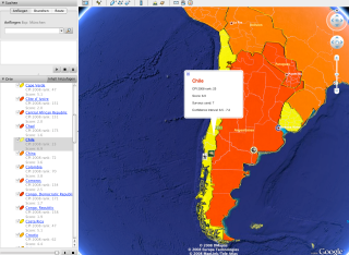 |
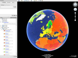
| By opening the kml.-file in Google Earth you will see each country's CPI indicated by color. | If you click on a country the details regarding the CPI will appear in a small window. |
###
The world borders set used is derived from thematicmapping.org. The dataset is available under a Creative Commons Attribution-Share Alike License.